

In the summer of 2020, cruising south from Alaska to Seattle, we transited the Inside Passage through British Columbia, along the east coast of Vancouver Island. Since then, we had longed to return to this unique landscape.
For most of 2021, Covid 19 restrictions had prohibited us from entering Canada just for cruising purposes. We were eventually allowed to enter last summer to have maintenance work done on the boat, which we did in Canoe Cove, located on the southeast coast of Vancouver Island.
At that time, in order to clear Canadian Customs, we had to provide a Covid PCR test less than 72 hours old, which required a trip to the Bellingham airport, in Washington State. Finally, in May 2022 the restrictions were lifted and we entered Canadian waters by simply uploading a copy of our passports and documentation of our Covid vaccinations to the ArriveCAN app on our iPhone. This time, we were able to cruise straight into Van Isle Harbor in Sydney, BC (north of Victoria) and, after clearing Canadian Customs, we headed north to cruise Desolation Sound and Princess Louisa Inlet.

Heading North to Desolation Sound
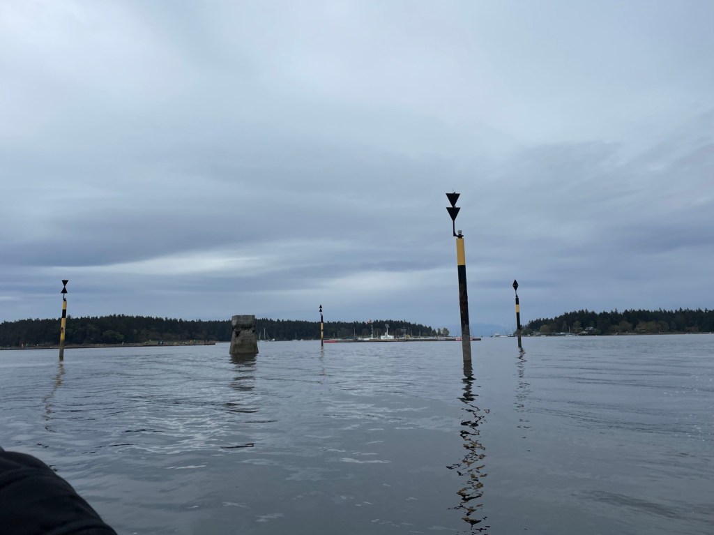
We made our first stop in Galiano island and the next day in Nanaimo.


Desolation Sound
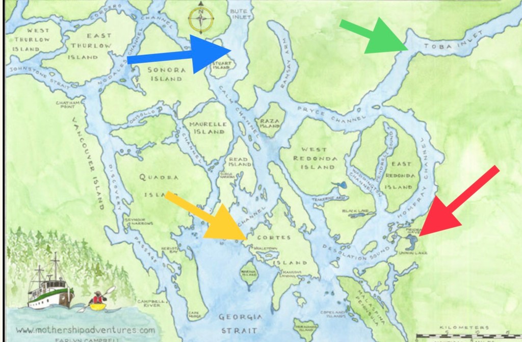
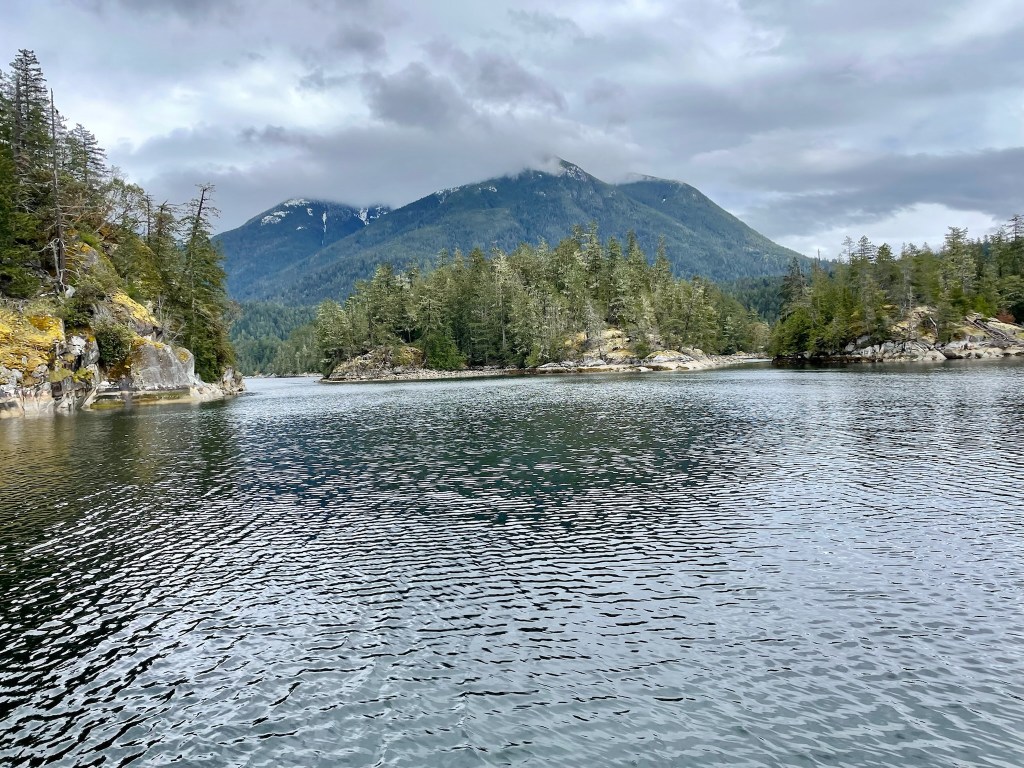
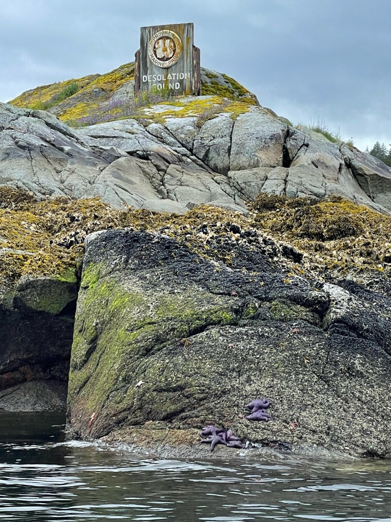
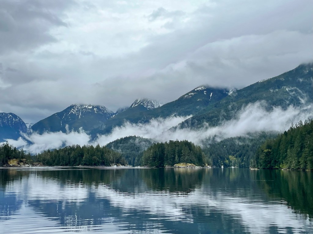
Desolation Sound had been on Giorgio’s mind as a ‘bucket list’ destination for at least a year. Known for its deepwater coves and mountainous fjords, it is located at the northern end of the Salish Sea at the tip of the Strait of Georgia, about 95 miles north of Vancouver, British Columbia. Apparently, the surrounding waters are considered to be warmer than further south, but the weather we had in May was grey and rainy; hardly enticing for a swim.
The area has been inhabited by several Native American tribes. In the summer of 1792, Captain George Vancouver, while exploring and mapping the sound, named it Desolation Sound claiming “there was not a single prospect that was pleasing to the eye”. I am not sure that I agree with Captain Vancouver; although remote with little civilization, the lush green forests and majestic mountains were very pleasing to our eyes. Maybe Captain Vancouver was very disappointed by the fact that this area has no cell towers and no WiFi coverage, yesterday as much as today.
Geologically, for the past 170 million years, the North American and Pacific Ocean plates have been colliding in the Pacific Northwest. The North American plate has been pushing west, sliding over the thinner and denser oceanic plates. Pacific volcanic islands, built on those oceanic plates, became stuck to this moving front of North America. In addition, about 15,000 years ago, the Ice Age created glaciers that scoured valleys, carved mountains, and rounded lower ridges. It is estimated that the area was covered by ice over 2 kilometers thick! Today, these impressive landscapes make up this breathtaking coastline of British Columbia.

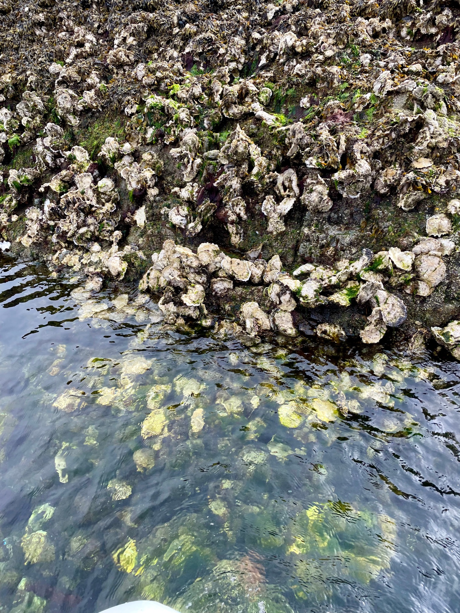
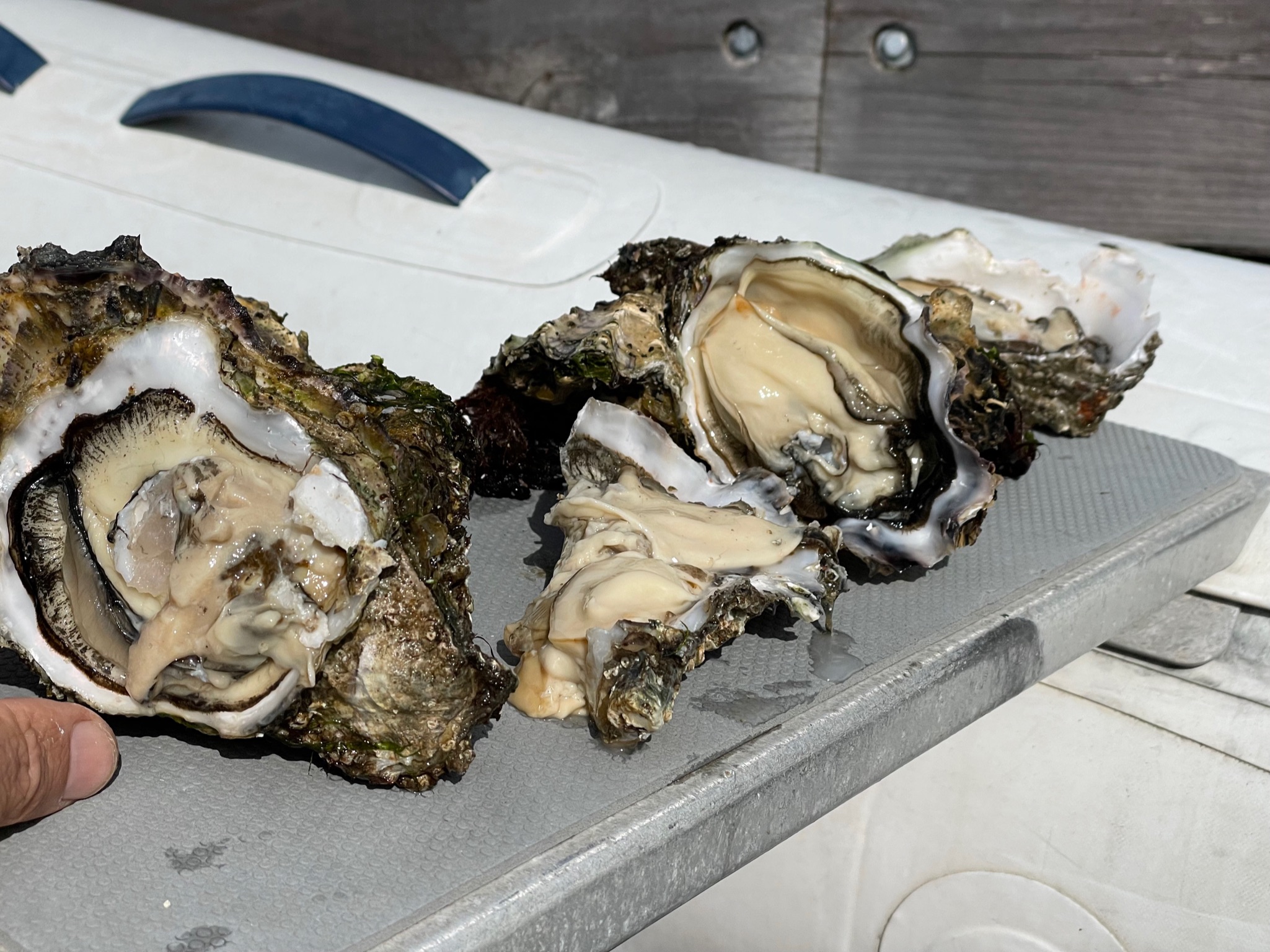
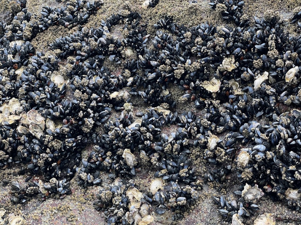
Our first stop in Desolation Sound was in Cortes Bay on Cortes Island which has outposts for both the Seattle and Vancouver Yacht Clubs. This pristine bay was full of huge oysters. As usual, Giorgio feasted on them.

The next day we walked toward a nice beach where we found some interesting stones left by someone in an artistic composition. We left them as we had found them.

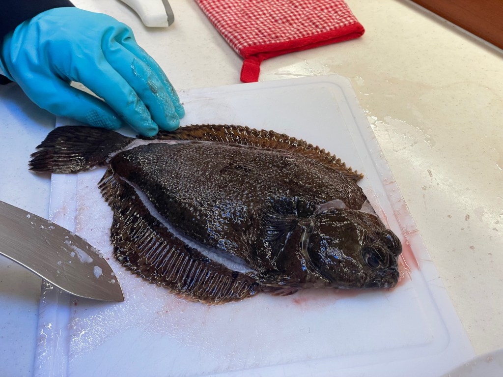
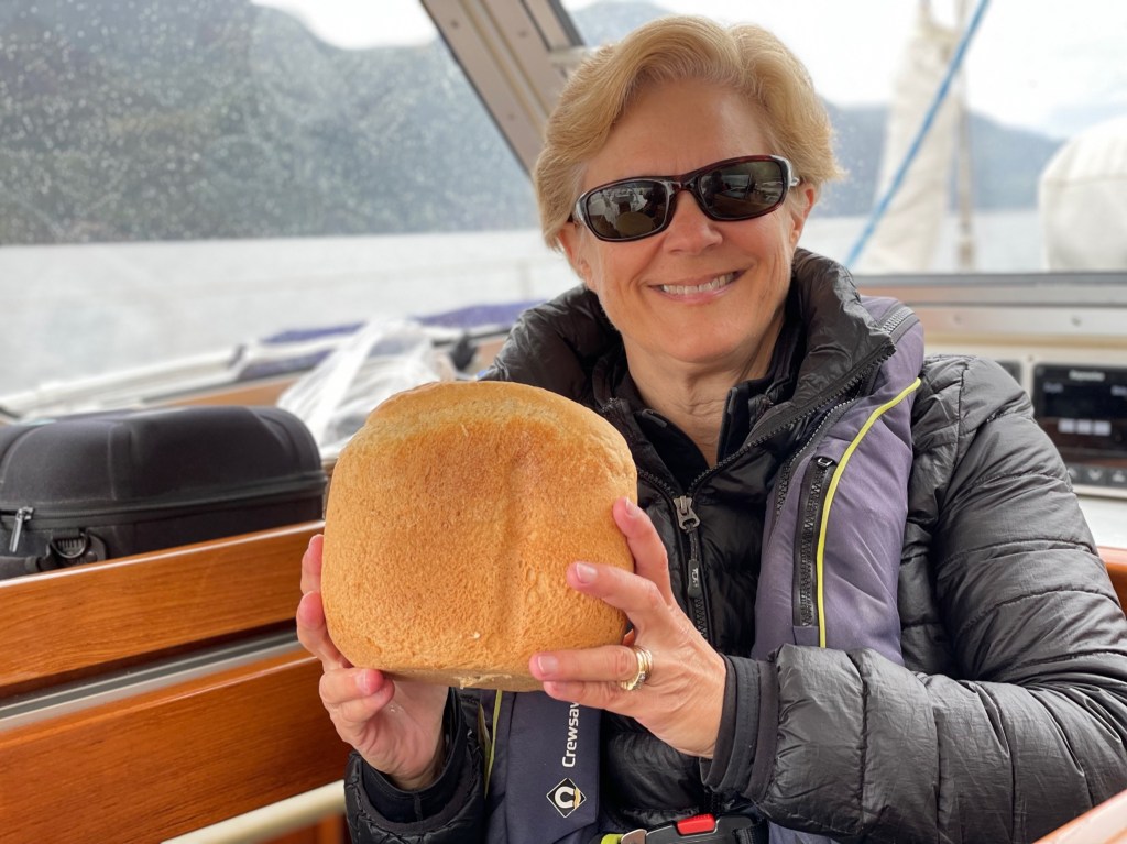
Next, we anchored in Brem Bay, Squirrel Cove, a little further north on Cortez Island. Giorgio found a delicious sole in one of his crab pots.
We also stopped by the store in Refuge Cove on West Redonda Island where we tapped in to the only WIFI we would find in the area. As previously mentioned, once you head further north into the sound, there is no cell service at all.
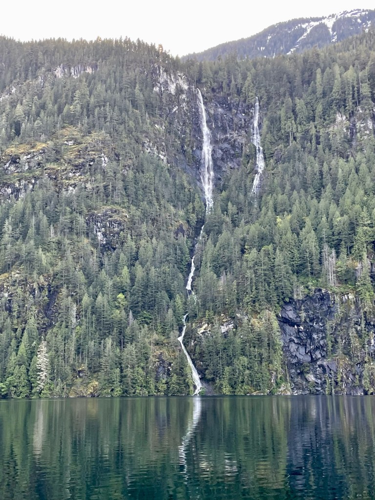
Over the next 3 days we went north to see the deepwater fjords of Bute and Toba Inlets. We loved watching the waterfalls and the emerald green dense forests that line the coast.
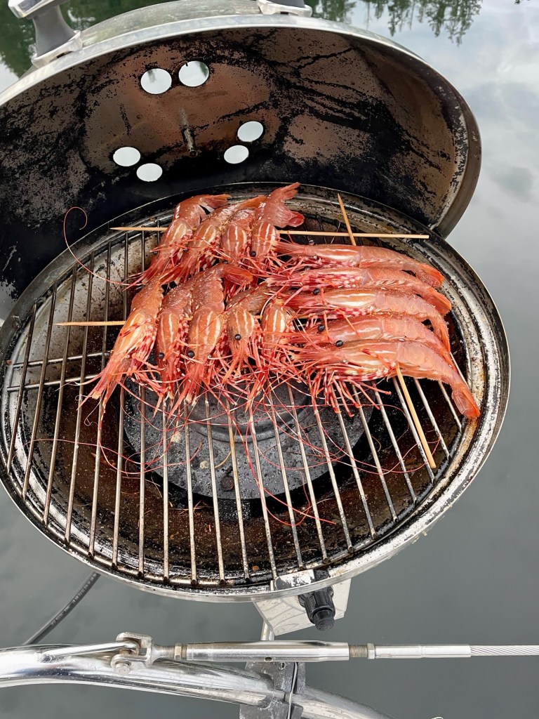
Equally beautiful and equally deep, both fjords were void of any places to anchor safely for the night. During our motoring, we passed a fishing boat and Giorgio hailed them to ask if they had any fresh fish. They had beautiful big prawns and we bought one kilo.
Hurrying along to see all we could and make it to an anchorage before dark, we ended up anchoring the first night at Frances Bay next to a fishing boat, near the south entrance of both fjords. Giorgio cooked the pawns in the BBQ. Yummy!
After exploring Toba Inlet that morning, we went south through Waddington Channel and enjoyed the beauty of the trees and coves. The narrow inlet into Prideaux Haven had some tricky currents as we entered the cove but the reward was a lovely, serene bay with only a couple of boats.


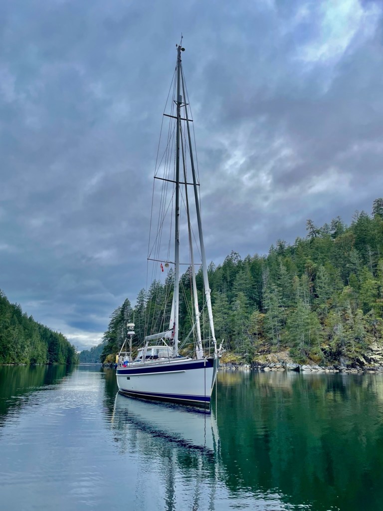
If the weather hadn’t been so cold and wet, I would have liked to walk in the surrounding forest. Despite the weather, we felt cozy in our warm boat surrounded by the towering mountains and lush green foliage.

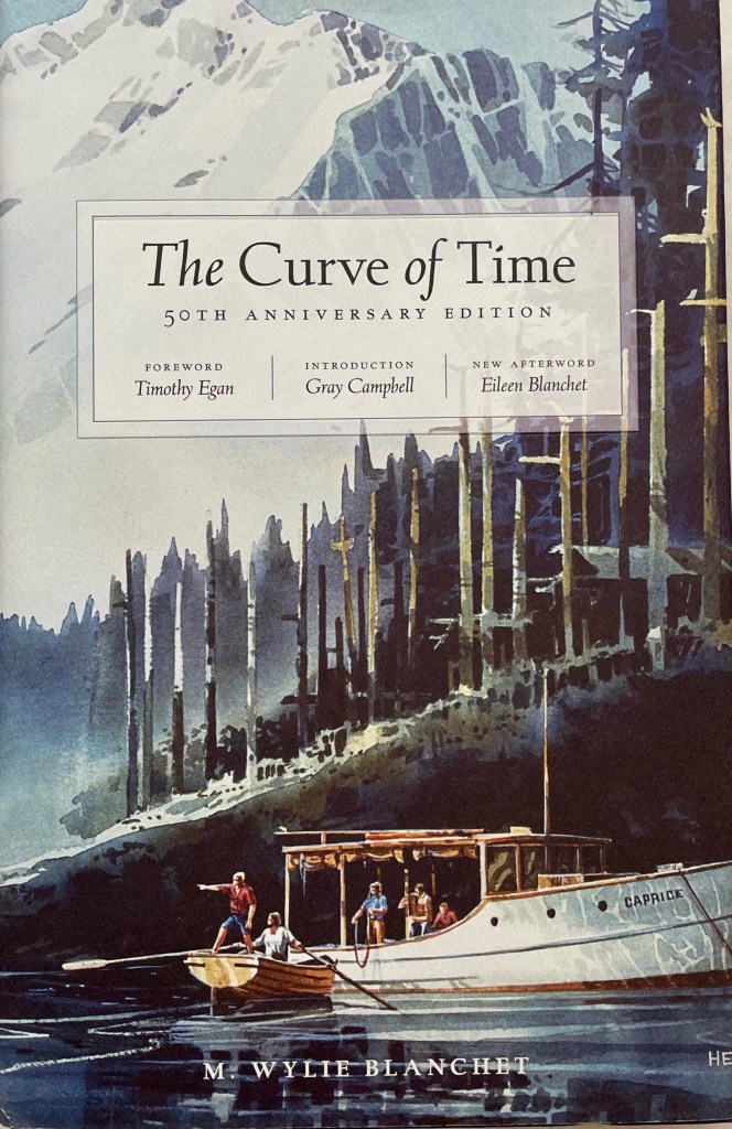
Prideaux Haven was specifically mentioned in the book The Curve of Time, by M. Wylie Blanchett, and was where the family met an intellectual, book loving hermit, who lived in a small cabin with lots of apple trees. This well known book is the story of a young widowed mother cruising coastal British Columbia with her five young children in a 25-foot boat during summers in the 1920s. They would return to Prideaux Haven every summer.
PLANNING OUR PASSAGE TO PRINCESS LOUISA INLET
We raised anchor at 06:00 to start our 80 nautical mile (NM) trip to Princess Louisa Inlet.

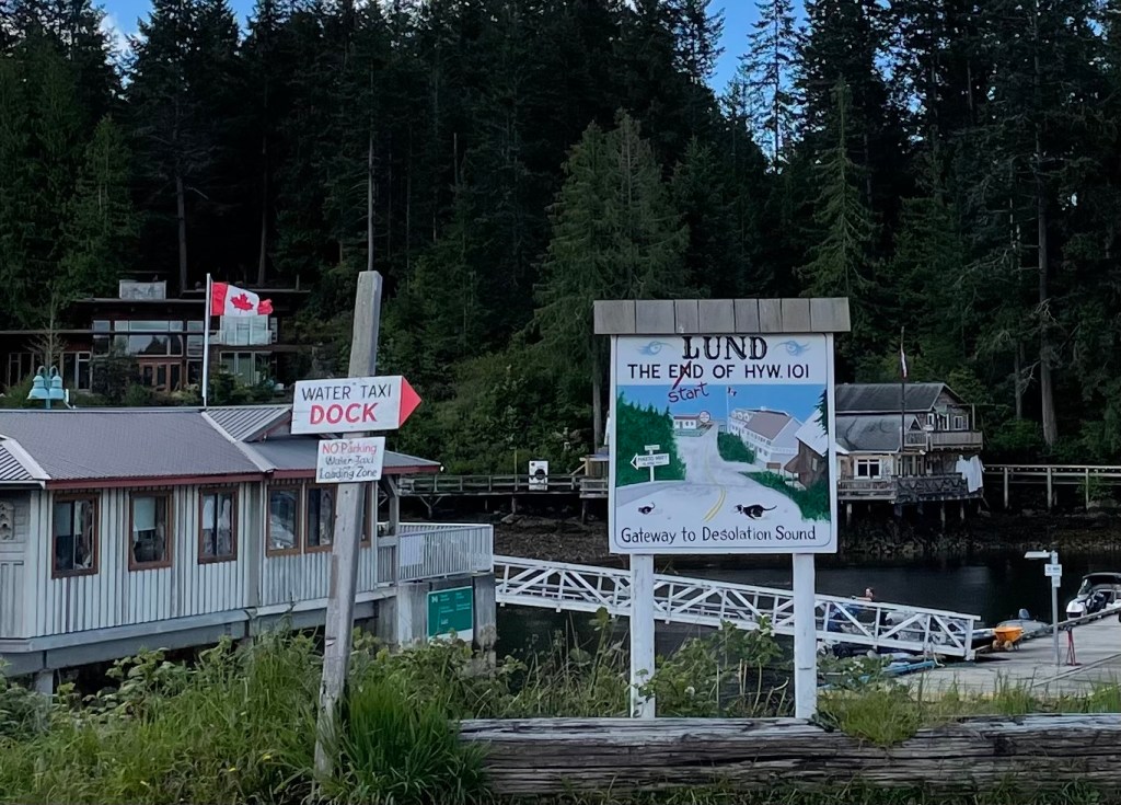
We made a stop to refuel in Lund, 15 NM to the southwest, which is located at the end of Highway 101. Lund is a very busy fishing harbor with a store and a bakery, which was unfortunately closed. We will probably go back one day to explore.
After refueling, we continued south in the Malaspina Strait and arrived at the entrance of the Jervis Inlet fjord at 14:00. Princess Louisa Inlet at Malibu Rapids was 42 NM up the fjord and we had about 7 hours before sunset.

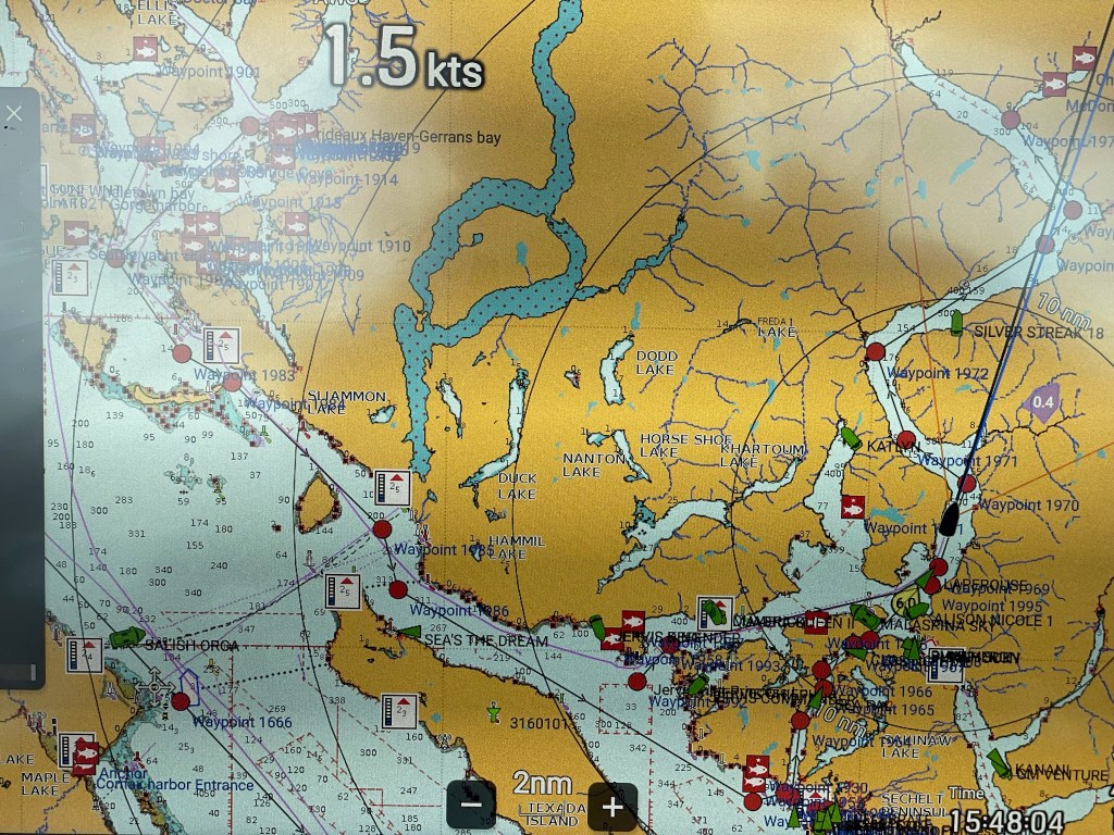
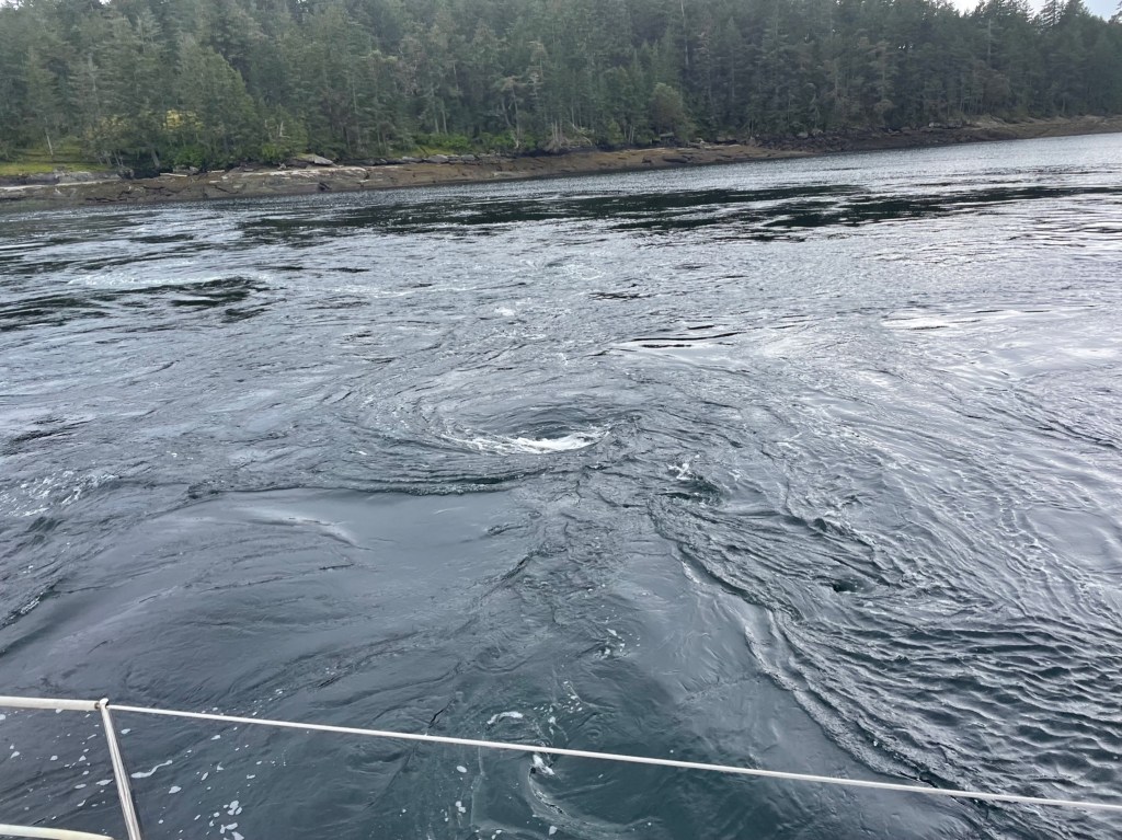
The timing of our entrance into Princess Louisa Inlet thought Malibu Rapids needed to be well planned in advance. Malibu Rapids flows through a narrow gorge and should be transited at slack water (in boater’s terms), or at the time when the currents are dead calm- not going in or out of the inlet. This fast moving tidal flow can reach 7-10 knots, which could easily push or pull the boat around. Also, the entrance has an S shaped bend so you cannot see any traffic or obstacles on the other side. The slack water that evening was predicted for 19:50, and we could enter 30 minutes before or after that quite safely and still anchor before nightfall.
Our ground speed motoring up the inlet was around 6 knots, so it took us about 7 hours to do the 42 NM. We arrived early at around 19:00, and also had the right wind for a short sail to Malibu Rapids.

Princess Louisa Inlet
After taking down the sails and firing up the engine, we entered the rapids around 19:30 after announcing our intentions on the VHF radio. At that time, with the rapids nearly at slack, the current was very gentle as we entered into one of the most incredible places on earth.
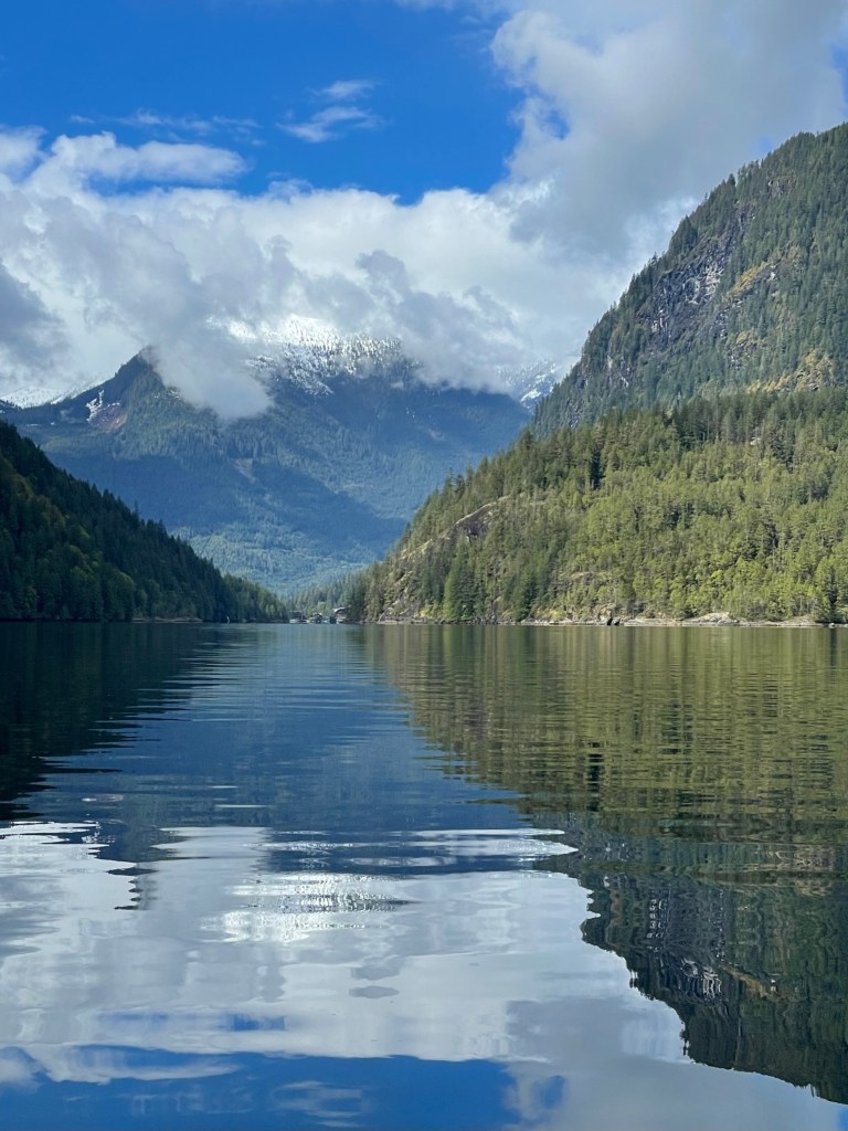
After maneuvering the bend into Malibu Rapids, we coasted into the waters of the massive granite walled gorge and lush forested coastline.
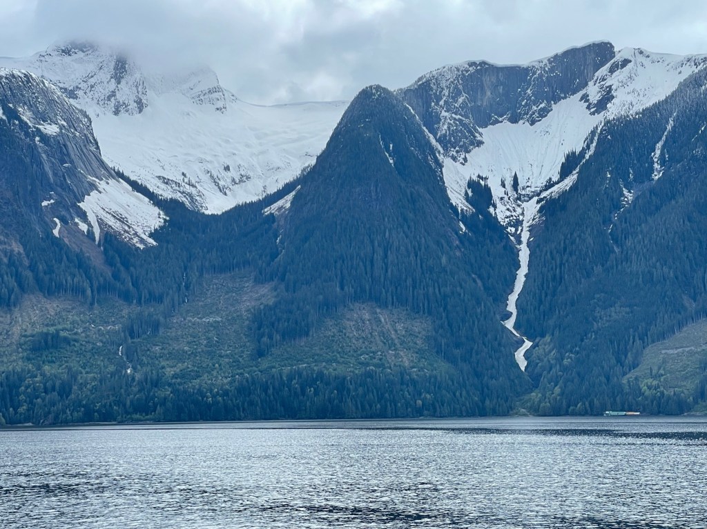
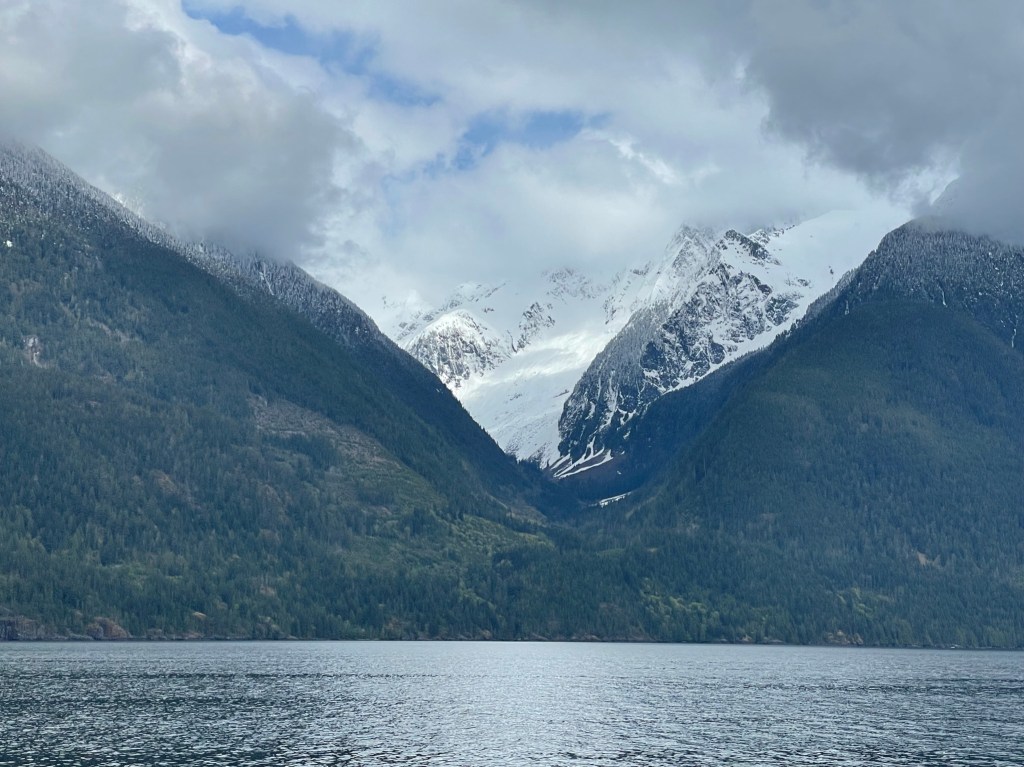
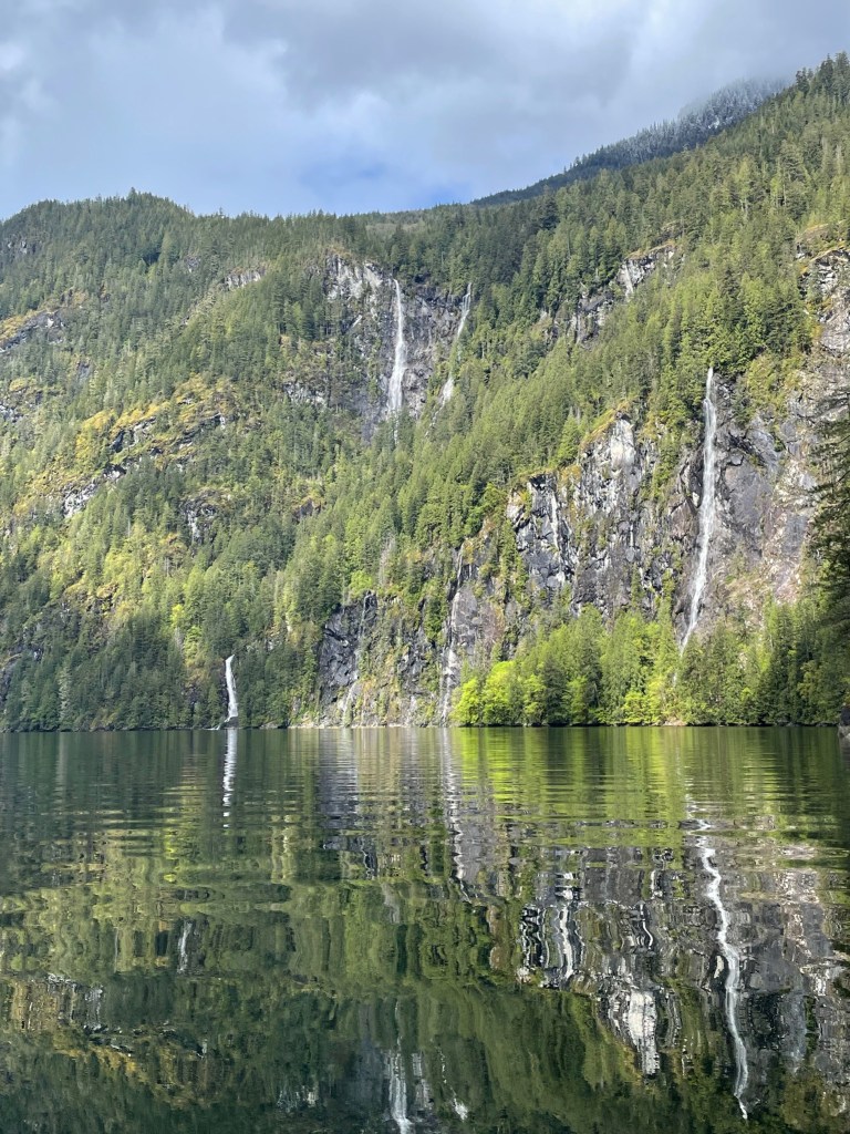
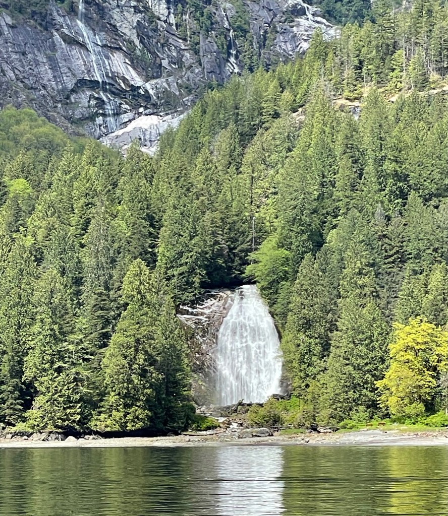
We then meandered the last 4 miles of remote wilderness to the end of the narrow (3/4 mile maximum width) fjord as we watched in awe as we passed waterfall after waterfall on both sides, the last being the best: the spectacular 120 foot tall Chatterbox Falls. This magical place is only accessible by boat or floatplane, and there are no public roads. The tall granite walls reflecting in the water, the snow capped 6,000 feet peaks and the countless plunging waterfalls were all surreal.
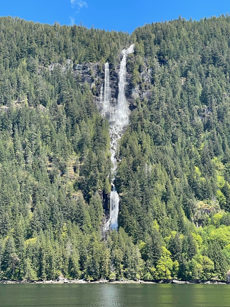
Preferring not to stay at the dock, we took the only remaining buoy and secured the boat in front of another beautiful waterfall, across the bay from Chatterbox Falls. The only sounds around were the muffled roars of the rushing waters as they plunged down from the cliffs.


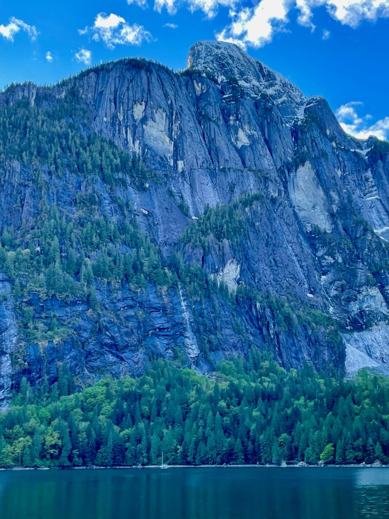
There are few places in the world that have captured our hearts like Princess Louisa Inlet. Some say it is the most beautiful anchorage in the world. The Inlet may have been named for Princess Louise, the fourth daughter of Queen Victoria, who was married to the Marquess of Lorne, the Governor General of Canada. It is also possible that it was named for Queen Victoria’s mother, Princess Victoria, who was born Mary Louise Victoria. Princess Louisa Marine Park was created in 1963, thanks to the gift of James F. “Mac” Macdonald, and is surrounded by 5,000 to 8,000 feet high snow covered mountains and is 1,000 feet deep in places.
The next day we explored the area near the base of Chatterbox Falls. We were hesitant to continue to up the hill due to the posted DANGER signage and the muddy trails.
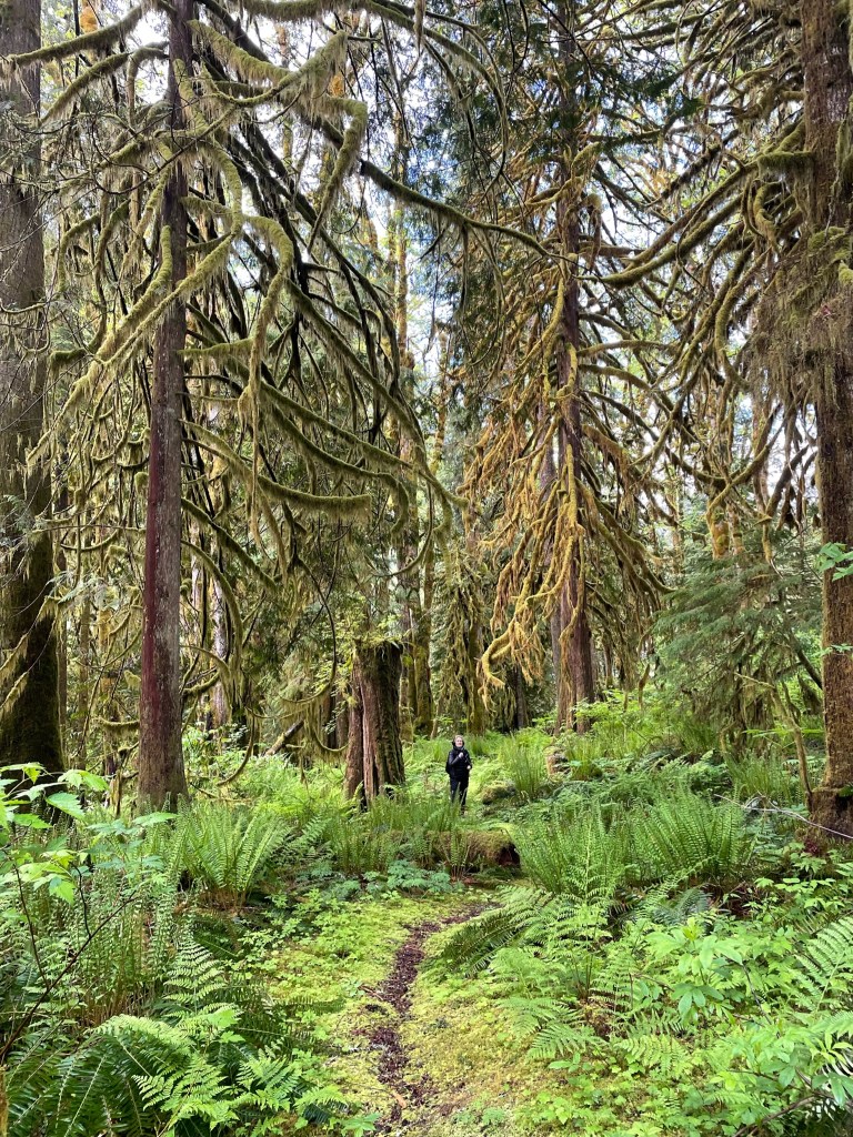
The third day we took the dinghy to Macdonald Island, a lush forest of tall trees and green moss. That morning we took a stroll in the woods and admired the very tall trees covered with moss.

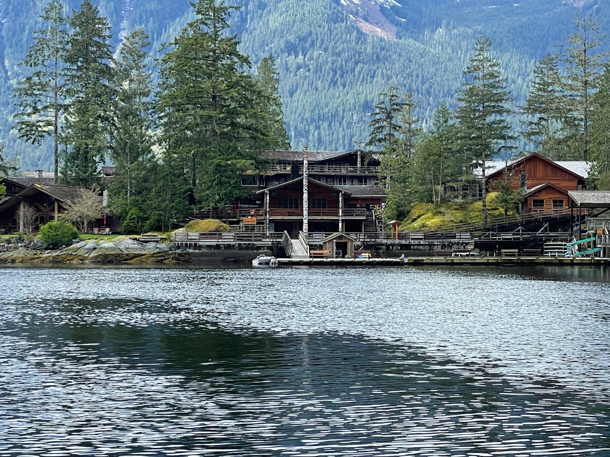
The same day, at the entrance of the fjord, we visited the impressive complex of the Christian Young Life Camp, using our faithful dinghy.


After four days in this Paradise, we departed Princess Louisa Inlet with a heavy heart promising ourselves to return one day. We again carefully timed our exit through Malibu pass, more serene this time, as we followed a long line of around ten boats that early morning. Going through the rapids again at slack, we already knew what to expect!
